File:19940720skmbnd.jpg
Jump to navigation
Jump to search
No higher resolution available.
19940720skmbnd.jpg (705 × 498 pixels, file size: 65 KB, MIME type: image/jpeg)
Captions
Captions
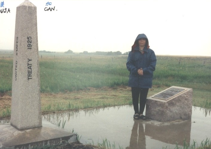
US/Canada border: the Manitoba, Saskatchewan, North Dakota tripoint
Summary
[edit]
| Description |
English: US/Canada border: the Manitoba, Saskatchewan, North Dakota border tripoint, looking NW. Close examination of the plaque next to Ms. Deng Yingyu reveals a figure of the two provinces, with their border of course placed upon the real border. In the middle of each province is pictured the provincial emblem, I believe. Elevation 471 m, 101° 22' W, 49° N. This monument, 670A, is an addition between monument 670 to the west and 671 to the east. |
| Date | 1994-07-20, 6:40 PM |
| Source | Own work |
| Author | Jidanni |
| Openstreetmap entry | Link to Openstreetmap |
| Object location | | View this and other nearby images on: OpenStreetMap |
|---|
Licensing
[edit]
I, the copyright holder of this work, hereby publish it under the following licenses:

|
Permission is granted to copy, distribute and/or modify this document under the terms of the GNU Free Documentation License, Version 1.2 or any later version published by the Free Software Foundation; with no Invariant Sections, no Front-Cover Texts, and no Back-Cover Texts. A copy of the license is included in the section entitled GNU Free Documentation License. |
| This file is licensed under the Creative Commons Attribution-Share Alike 3.0 Unported license. | ||
| ||
| This licensing tag was added to this file as part of the GFDL licensing update. |
This file is licensed under the Creative Commons Attribution-Share Alike 2.5 Generic, 2.0 Generic and 1.0 Generic license.
- You are free:
- to share – to copy, distribute and transmit the work
- to remix – to adapt the work
- Under the following conditions:
- attribution – You must give appropriate credit, provide a link to the license, and indicate if changes were made. You may do so in any reasonable manner, but not in any way that suggests the licensor endorses you or your use.
- share alike – If you remix, transform, or build upon the material, you must distribute your contributions under the same or compatible license as the original.
You may select the license of your choice.
File history
Click on a date/time to view the file as it appeared at that time.
| Date/Time | Thumbnail | Dimensions | User | Comment | |
|---|---|---|---|---|---|
| current | 02:31, 10 July 2007 | | 705 × 498 (65 KB) | Jidanni (talk | contribs) | {{Information |Description= US/Canada border: the Manitoba, Saskatchewan, North Dakota border tri-point. looking NW. Close examination of the plaque next to Ms. DENG Yingyu reveals a figure of the two provinces, with their border of course placed upon the |
You cannot overwrite this file.
File usage on Commons
The following 2 pages use this file:
Categories:
- Tripoints
- Provincial border signs
- Boundary stones of the Canada-United States border
- Water reflections of people
- Water reflections in Manitoba
- Reflections in puddles
- July 1994 in Canada
- 1994 in Manitoba
- 1994 in Saskatchewan
- 1994 in North Dakota
- 1925 monuments and memorials in Canada
- Puddles in Canada
- Commemorative plaques in Canada
- Photos with text added